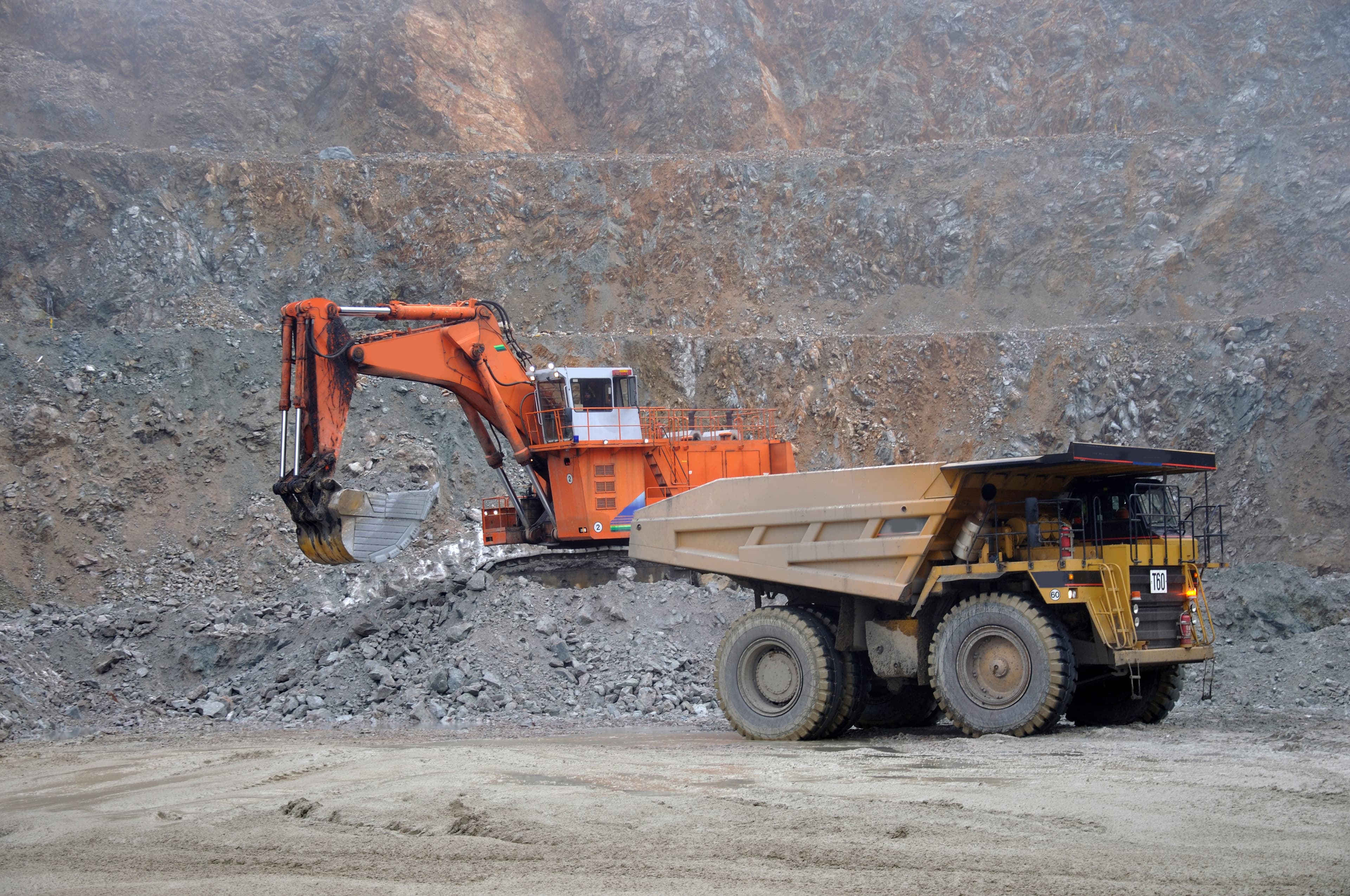
New Zealand uses around four million truckloads of aggregates each year in roading and construction and has around 2500 quarries. However, aggregates are bulky and heavy, and carting them from a quarry to where they’ll be used is much of their cost.
A truckload of aggregate roughly doubles in price after 30 km, and the further it has to be carted, the greater the road wear costs and carbon emissions. So, the closer that aggregate sources are to where they’ll be used the better.
Where there’s high population growth, it’s crucial to look some years out – to plan where future quarries should be developed to support community and industrial projects. Such forward thinking helps secure reliable and affordable supplies of aggregates in the future and ensures that any impacts on the environment or our communities are managed.
To this end, we commissioned GNS Science to do a high-level mapping exercise to identify suitable aggregate resources throughout New Zealand in 2021. Then later to identify potential extraction opportunities close to four high-growth areas – Auckland, Tauranga, Queenstown and Wellington.
This more detailed mapping work goes beyond national-scale geology and regional economics to include other factors that will be useful to councils who are considering developing spatial plans – such as detailed land use analysis, quarry feasibility estimates, and social constraints like public visibility/impact values.
These maps show areas of ‘aggregate opportunity’ – places where a combination of factors make them potentially suitable for quarrying. Of course, further work would be needed before a council can use these maps to protect land for future extraction or a quarry operator can confirm a new site. Engaging with local communities, residents and iwi remain a critical part of the process and was not a focus of this research. Likewise, the geological data in the maps would need to be confirmed and the actual quality of the available rock determined – through ground investigations.
These latest studies are attracting the interest of councils. Already, the Wellington Regional Leadership Committee, which includes councils, iwi and central government in the Wairarapa-Wellington-Horowhenua region, are considering how to use their report to identify where aggregate supply opportunities are available for their region, and how to secure these resources for future generations using tools such as guiding land use and rules in the regional and respective district plans.
Aggregate opportunity modelling for Auckland
Due to the size of the Auckland area, and that resources are often trucked from the Northland or Waikato regions into the city, the Auckland study was divided into a northern Auckland area from Whangarei to central Auckland and a southern Auckland area down to south of Hamilton City.
Auckland North
The northern Auckland area is fortunate to have large areas of hard rock, much of this material is exposed at or near the surface, providing access to good-quality resources. Hard rock aggregate opportunity occurs in the occurs west of Matakana, east and northeast of Brynderwyn, and east and west of Whangārei. Gravel opportunity is limited. However, there is excellent sand opportunity – with extensive sand dune complexes along the west coast and some coastal deposits on the east that may provide good resources of sand for concrete.
Auckland South
This area has excellent opportunity for hard rock, gravel and sand aggregate. The hard rock sandstone opportunities occur in the Hunua, Hapuakohe and Pakaroa ranges south of Auckland City and east of Hamilton City, with volcanic rock opportunities throughout the Pukekohe, Hunua, Raglan and northeast Cambridge areas, and southeast of Raglan and southeast of Cambridge. Good gravel opportunities also occur on the Hauraki Plains in the east of the study area as well as northwest of Huntly and southeast of Morrinsville. Sand opportunities are on the along the western coastline where extensive sand dune complexes exist. Although this area has good potential, some rock may be deeply weathered so less economic, and sites historically used for gravel and sand extraction now occur near populated areas or in zones of highly productive soil so potential availability is challenging.
Aggregate Opportunity Modelling for the northern Auckland area
Download
Aggregate Opportunity Modelling for the southern Auckland area
Download
Aggregate opportunity modelling for Tauranga
Aggregate opportunity in this region is quite challenging, as many hard rock deposits in the Bay of Plenty are far from the populated areas and the region’s gravel and sand deposits occur in densely populated flat and coastal areas and comprise of softer volcanic material.
The highest hard rock aggregate opportunities for sandstone are south and southeast of the Whakatāne and Ōpōtiki districts (sandstone), while volcanic hard rock opportunities are on the Coromandel Peninsula and between Tauranga and Rotorua and may be highly weathered. The highest gravel opportunities occur on the Hauraki Plains and north of Murupara, southeast of Rotorua. Sand opportunities are concentrated along the coast from Tauranga to Ōpōtiki where there are extensive sand dunes and beach sediments.
Aggregate Opportunity Modelling for the Bay of Plenty area
Download
Aggregate opportunity modelling for Wellington
The Wellington Region is fortunate to have large areas of hard rock and gravel deposits that could potentially be utilised for aggregate supply. However, these are limited by the fact that the region is densely populated in flat areas and many steep sites are not easily accessible.
Most hard rock aggregate opportunities occur from Pukerua Bay to Otaki, in southern Wellington City, around the Pautahanui area, and along the western side of the Wairarapa districts.
The gravel aggregate opportunities are mainly in the central Wairarapa area and parts of the Kāpiti Coast.
There are also good sand opportunities on the Kāpiti Coast, where extensive sand dune deposits provide a suitable sand-only source rock, as well as parts of southern Wairarapa.
Aggregate Opportunity Modelling for the Wellington Region
Download
Aggregate opportunity modelling for Queenstown/Central Otago
Schist rock is widely available around central and northwestern Otago. However, schist is not useful for roading chip or other high-wear applications as it has minerals and rock layering that easily breakdown during weathering and compaction.
The most sought-after aggregates are hard, dense rocks. Central Otago has sandstones and basalt that meet these criteria, but they are found some distance from the main Queenstown Lakes population areas. The sandstone opportunities are northeast of Clyde while the basalt ones are nearer Dunedin.
The best gravel opportunities are east of Wanaka, around and north of Lake Dunstan, in the Manuherikia and Ida valleys and in the Taieri Plains near Ranfurly. And sand is likely to be found within many of the gravel opportunity sites. However, these sands or gravels may or may not be suitable – depending on their mica content (which can only be learned through site exploration).
Aggregate Opportunity Modelling for the central and northwestern Otago area
Download
Published on 5 June 2024

Aggregate opportunity maps
These detailed maps go beyond national-scale geology and regional economics to include other factors that will be useful to councils who are considering developing spatial plans – such as detailed land use analysis, quarry feasibility estimates, and social constraints like public visibility/impact values.
Aggregate opportunity modelling 2021 research
This research from 2021 establishes a guide for potential future quarry developments as a basis to protect these resources for future generations. It set the groundwork for the detailed mapping in the five areas above.
Aggregate opportunity modelling for New Zealand
Download